ANDERSON'S CREEK & FOURTH HILL


* CLICK ON IMAGES FOR FULL SIZE *


Johnson's Mine
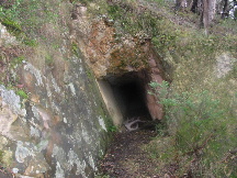
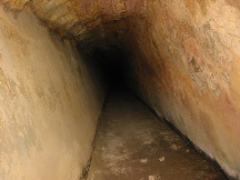
The Johnson's mine adit. Located about 30 mtrs up the hill (north west) from the monument mine shafts. This adit is different to the norm as it has been tunneled in at an angle. You can see the left rock face helps to hold up the back (ceiling) of the adit. By following the natural direction (dip) of the rock, the adit is a lot more stable. Either that or Mr Johnson's left leg was a lot shorter than his right ;-).


Johnson's Mine - Inside
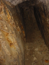
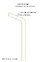
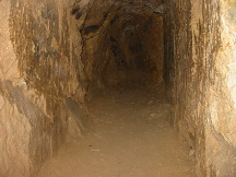
Just inside the entrance of the Johnson's adit. The walls may be at an angle but the floor is flat and the adit goes straight in for about 60 mtrs or more before turning to the left. After tuning to the left, the adit goes in for another 20 mtrs or so before coming to an end (see the map I have drawn below). There are no winzes (shafts) or stopes in this mine (just one very small drive). The floor is level and the adit is in a very stable and safe condition. Even so, Parks Victoria have now fenced-off the entrance to this mine. Please stay out of the mine. Take a look at my photographs and map instead.


Johnson's Mine - Quartz Reef
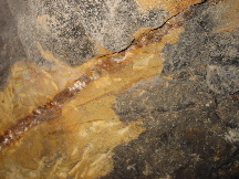
The miners intersected a vein of quartz about 10 mtrs from the end of the adit. The quartz vein is only about 2 cm thick and there is no show of gold.


Johnson's Mine - Drive
After intersecting the quartz vein, they dug a very small drive (drift) to the right to sample the quartz for gold.


Johnson's Mine - End of the Adit
The end of the adit. A lot of hard work and expense for no return. After finding no sign of gold in the small reef, they dug/blasted the adit in for another 10 mtrs or so before abandoning the mine.


Johnson's Mine - Map
Map I have drawn of Johnson's adit (may not be to scale).


This is my interpretation of the Johnson�s gold mine.
If anyone has any information about this mine, please email me. I would be grateful.